
Geoff Watkins is a local resident who provides professional drone services, he is fully qualified and works with local councils and heritage sites on complex projects through his business Aerial Imaging South East.

Geoff’s professional photography and videography is incredible and he captured some wonderful photos of the Medway towns for residents and commercial projects. Geoff told CommunityAd that drones get a lot of negative press and are often demonised; he hopes to show people that when used safely and legally by properly trained or qualified pilots, they are a brilliant tool and entirely safe and that they can produce some beautiful shots. All of his flights are completely legal and are conducted with safety as a top priority; he is Civil Aviation Authority Approved, a UAV/SUSA Operator and is fully insured.
CommunityAd talked to Geoff to find out about his videography and photography of the Medway towns.
Why did you decide to start Aerial Imaging South East?
I started AISE as I needed a change from my previous job as a driving instructor. I did that for 15+ years and needed a change. I had a love of photography and a love of gadgets and toys. I had a few drones over the years as a hobbyist but decided to turn it into a business at the end of 2019.
What’s your favourite part about being a drone pilot?
I enjoy being outside and capturing views for clients (or the public on social media) that they would never have seen before. People love seeing their towns from above.
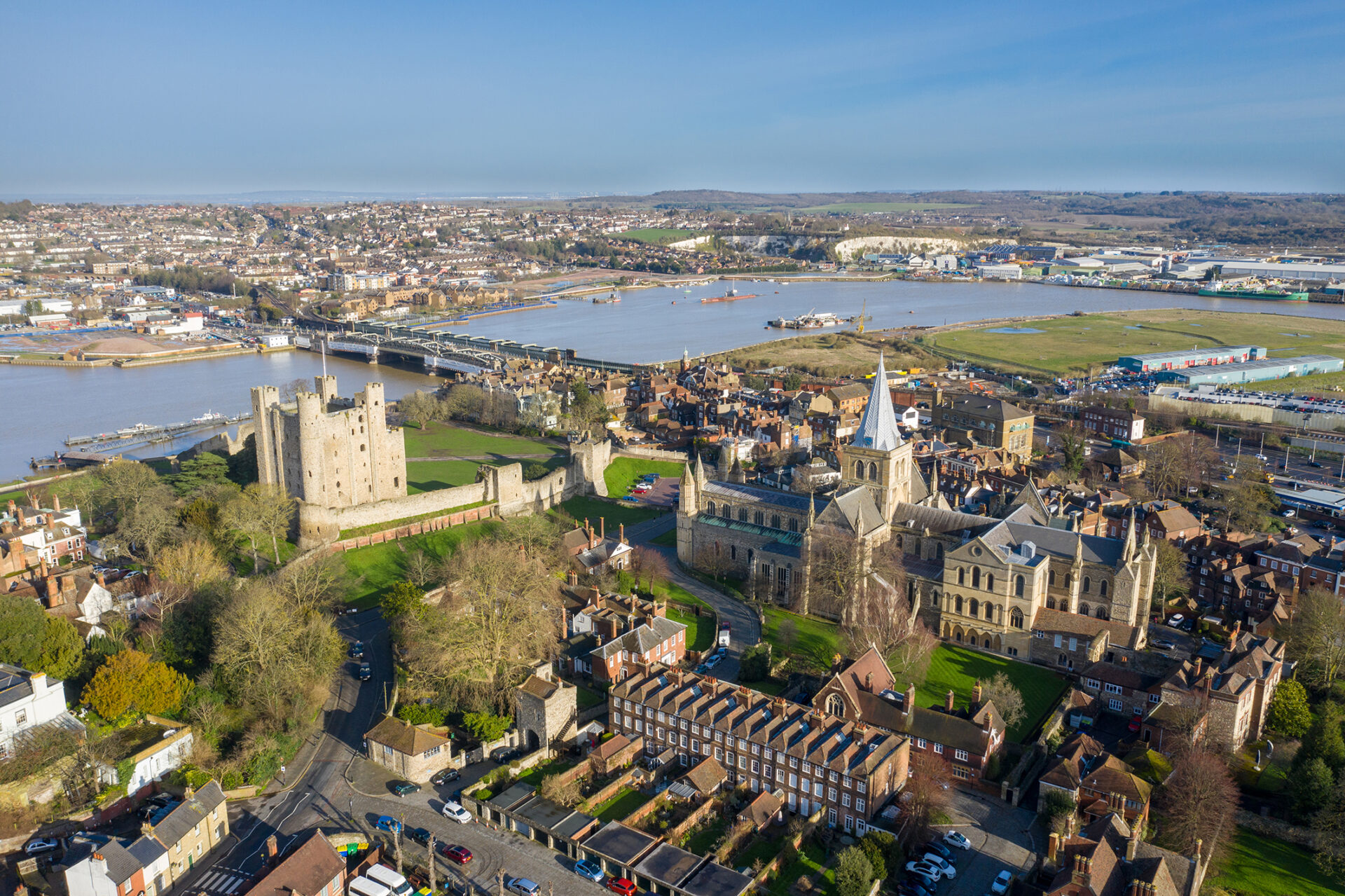
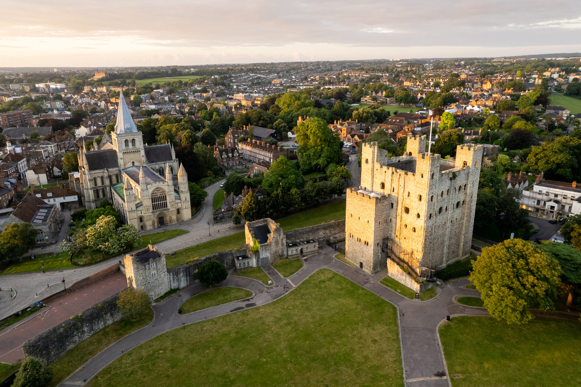
I’ve been very lucky and worked on various projects with Medway Council, Rochester Bridge Trust, Rochester Cathedral, Chatham Historic Dockyard Trust, and many other businesses across Medway and Kent. It’s been an absolute privilege to work with and capture images of such iconic and beautiful places.
What are some of the most interesting video requests you have received?
I get requests all the time to capture images of different places, and I do like to visit new places in my spare time. However, I need to balance this with doing paid jobs, as I will be quickly out of business if all I did was take requests and post stuff on social media!
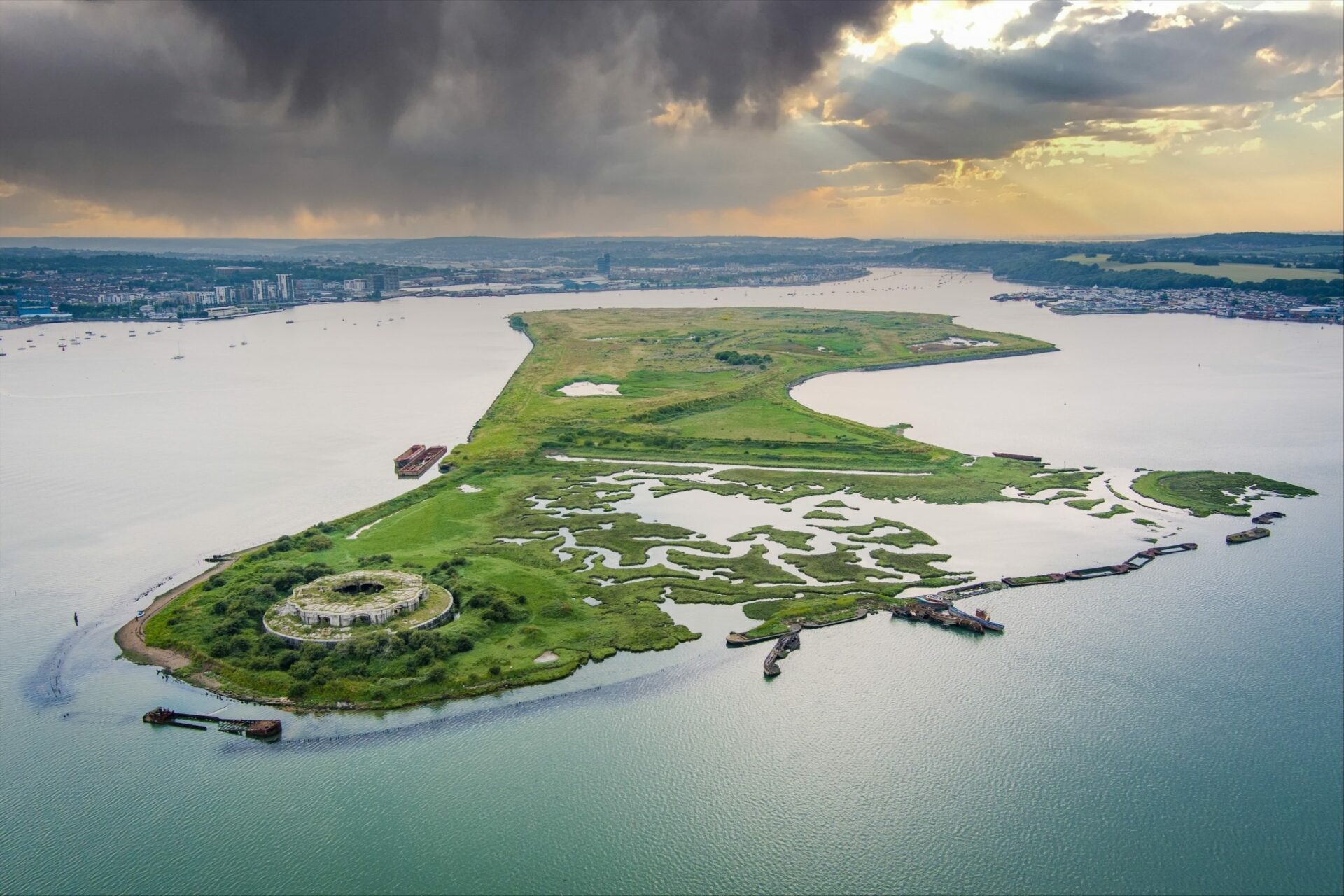
I get requests to do things that just aren’t possible or legal, like flying great distances to the forts in the Medway (Hoo and Darnet). Although the drones could do it, it would be against the law to fly the drones so far beyond the visual line of sight.
I have even had requests from people wanting me to drop things in places I shouldn’t be flying and offering quite a lot of money for it. I politely turn down the requests explaining a bit of money is not worth my career or prison time!
Have you had a good response from the community?
I do get a great reaction from the community for the things I post. It’s so lovely to read the comments and people’s stories from what they remember about the areas I’ve photographed. There are occasionally people complaining about drones/privacy, however, people often get emotional when I show photos of the green spaces and countryside, believing it will all be sold off for one development or another.
One of Geoff’s projects is the beautiful Rochester Cathedral.
To better understand and to preserve the features that adorn the building, the Rochester Cathedral Research Guild have been digitally recreating the building and details using high-resolution photographs and videos, to create stunning digital models.
Large parts of the Cathedral are difficult or impossible to access, so getting good high-resolution photographs or video was a challenge. Furthermore, to accurately create the 3D digital models, the features need to be captured from as many different angles as possible.
Having already done some aerial photography for the Cathedral, Geoff was contacted to discuss whether it would be possible to use drones to help image some of these hard-to-reach areas. After some discussion, it appeared to be entirely plausible and safe to carry out, so a proof-of-concept flight was arranged to see how well the drone footage works with the 3D rendering software.
“The flight was challenging, occasional gusts were coming from different angles around the building, and we were working in a fairly confined space. There was a large tree in the area of interest, meaning I was having to position the drone with extreme care while capturing the images.”
Geoff told CommunityAd that he had yet to capture anything too crazy or bizarre in his journeys, but perhaps one day.